Your introduction
The phone your crew carries becomes a centimetre-accurate field tool, synced to the office in real time.
Put your site plans on the map and work straight from your phone. No measuring wheels, no paper chaos, no surveyor required.
Field reality
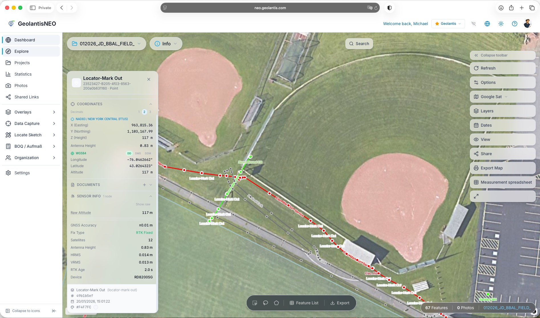
The office thinks it knows what is underground. The field finds out. That gap is where strikes, redesigns and disputed as-builts come from. GeolantisNEO closes it — load your plans, see your live position, capture what is actually there to the centimetre.
neo.geolantis.com
No more paper
Rolled-up drawings tear, blow away and never show where you are standing. GeolantisNEO puts your plans on a live map, tracks your position on them, and keeps every measurement and photo in one place.
One app
One app to capture. Another to stake out. Others for GIS, photos and reports. GeolantisNEO brings every field workflow into a single, multi-user app on shared live data — with simple licensing even for view-only users.
Fewer apps · fewer handoffs · one source of truth
Stake out
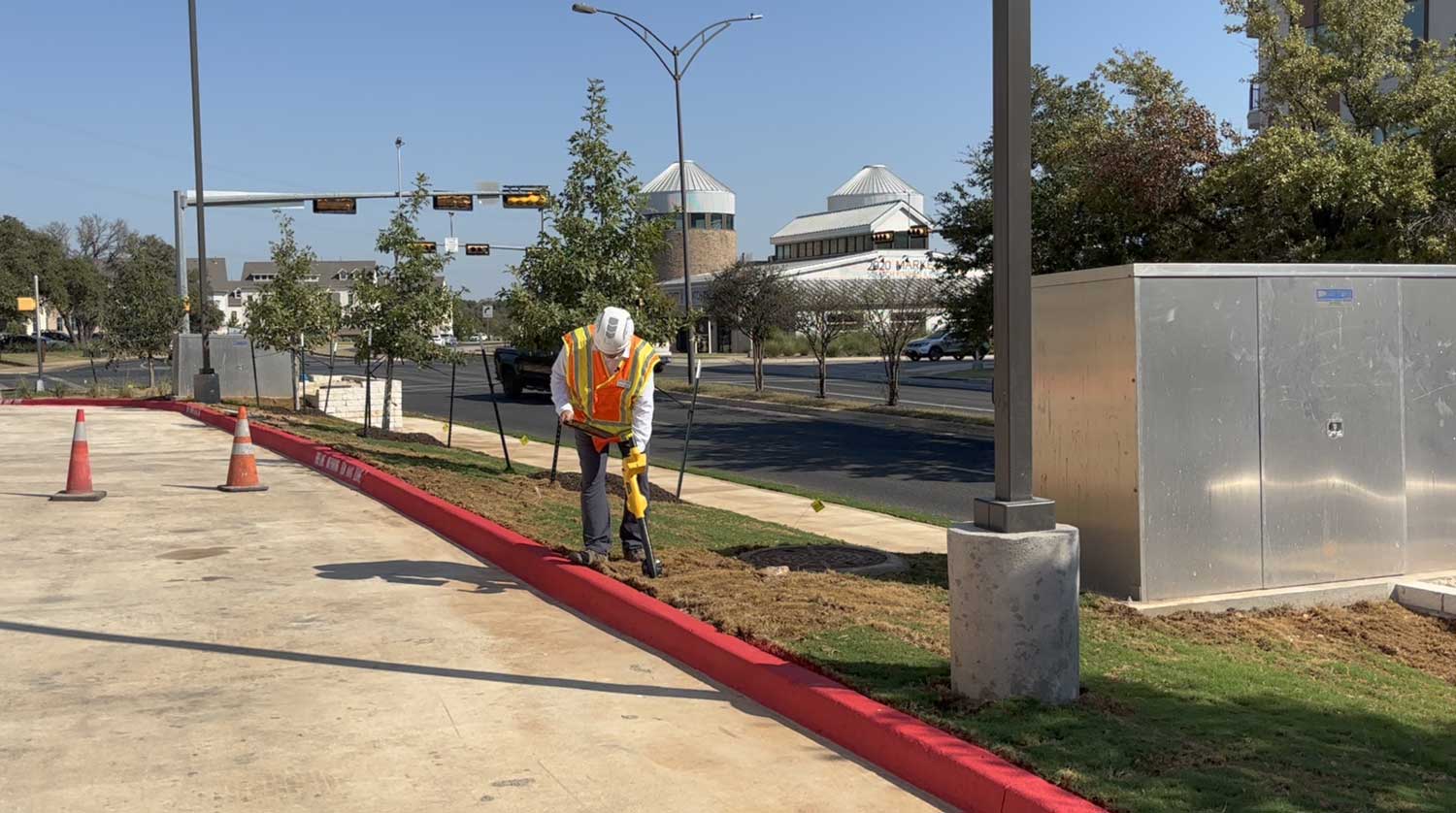
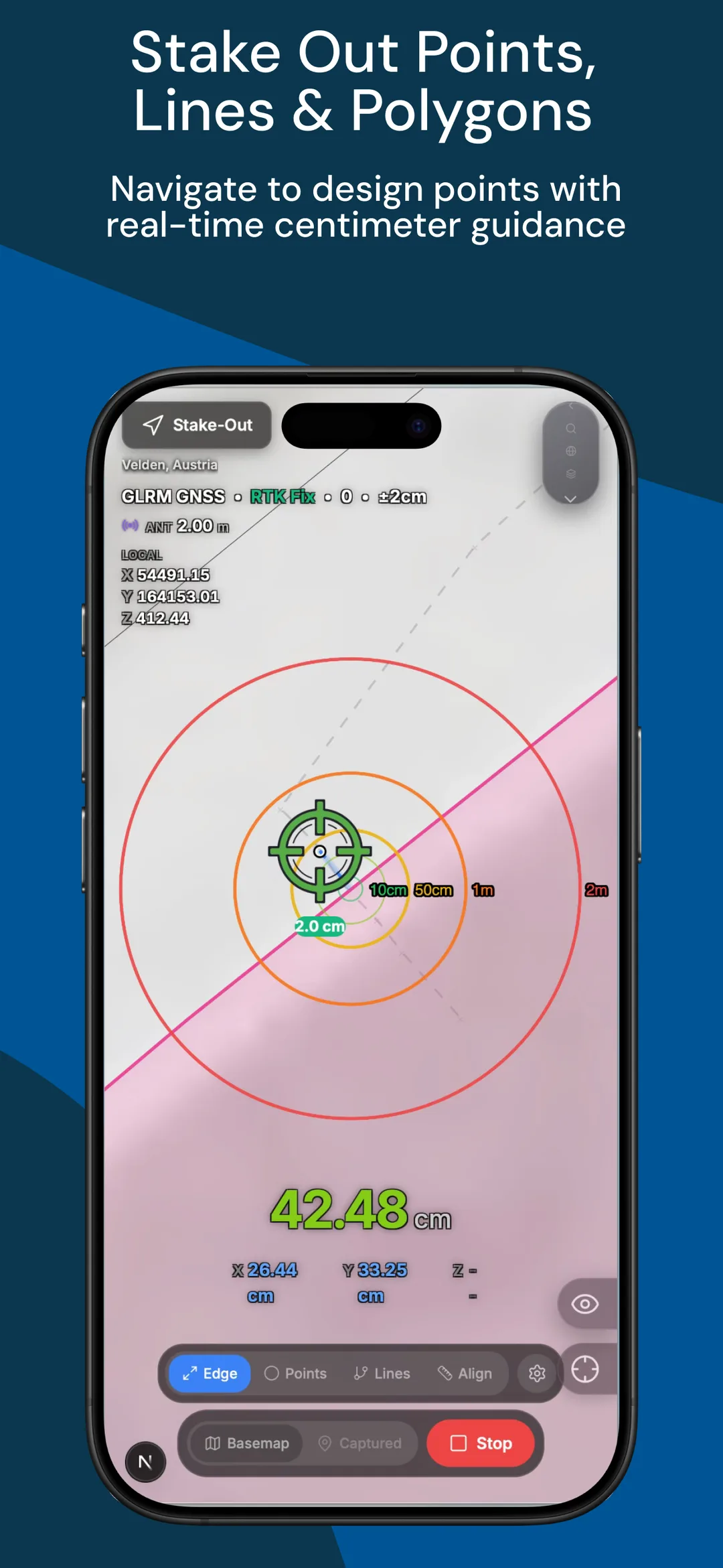
Waiting on a surveyor for every set-out stalls the crew and blows the schedule. Your trained crew stakes out points themselves, with live GNSS guidance to the centimetre. Import your coordinate list and start on site immediately.
Damage prevention
One transcription slip and the next crew digs into a live line. When locates are sketched by hand and re-keyed into GIS at night, the evidence is not standardised and not defensible. Capture, evidence and report locate outcomes with professional spatial accuracy, in the field.
From marking the ground to delivering trusted evidence
Field to office
What your crew captures on site lands on the office screen in real time. Same data, one truth, no re-keying and no version chaos. Works offline and catches up the moment you reconnect.
Spatial confidence, from the trench to the desk
Hardware agnostic
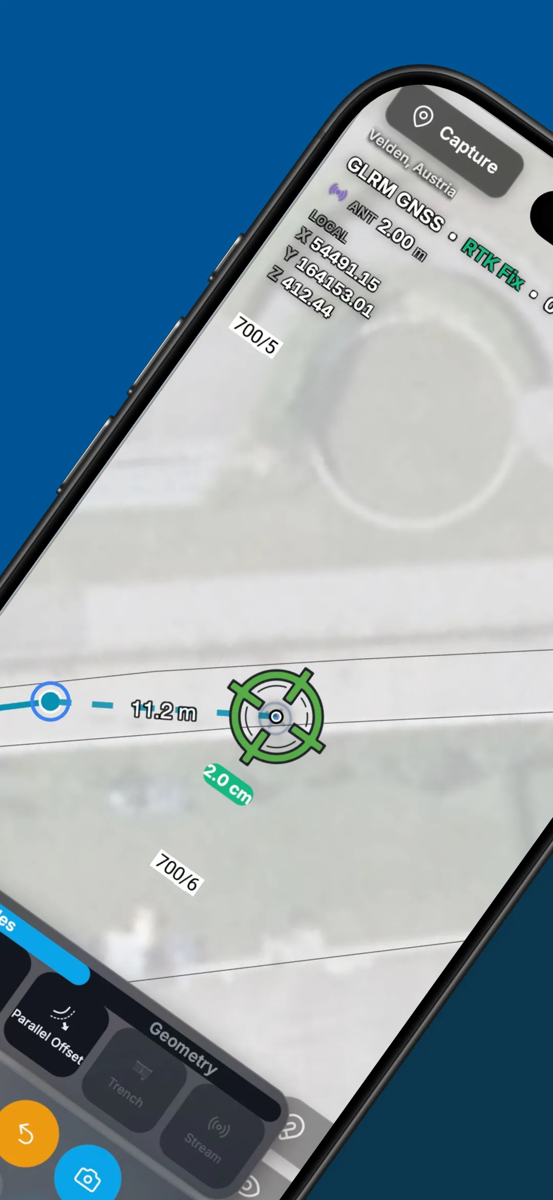
Survey-grade accuracy without the vendor lock-in. Connect the GNSS receiver you already own, or clip on the pocket-sized GLRM for ±1 cm RTK. Bring your own hardware, keep your workflow, lose the friction.
Evidence
Every photo is automatically stamped with precise coordinates and placed on the plan and the map. Watertight evidence for billing, claims and as-builts.
Interoperable
Capture once in the field, then export in one tap. Coordinate-aware, ready for the office, no re-typing.
Proof
Teams using GeolantisNEO measure faster, stake out themselves and bill with confidence. Join hundreds of construction and survey teams already on GeolantisNEO.
01 · LOAD
Load your plan
Import any PDF or CAD plan and georeference it — auto detection or a 2-point calibration.
02 · SEE
See your position
A real-time blue dot and heading on the plan — and it keeps working offline.
03 · CAPTURE
Capture & stake out
Mark points, lines and areas with snapping, or follow arrow guidance to set-out points.
04 · SYNC
Sync to the office
Field records appear back in the office automatically — no re-keying, one shared picture.
Snapping closes the gap
Vertices lock onto existing features — no gaps, no post-processing.
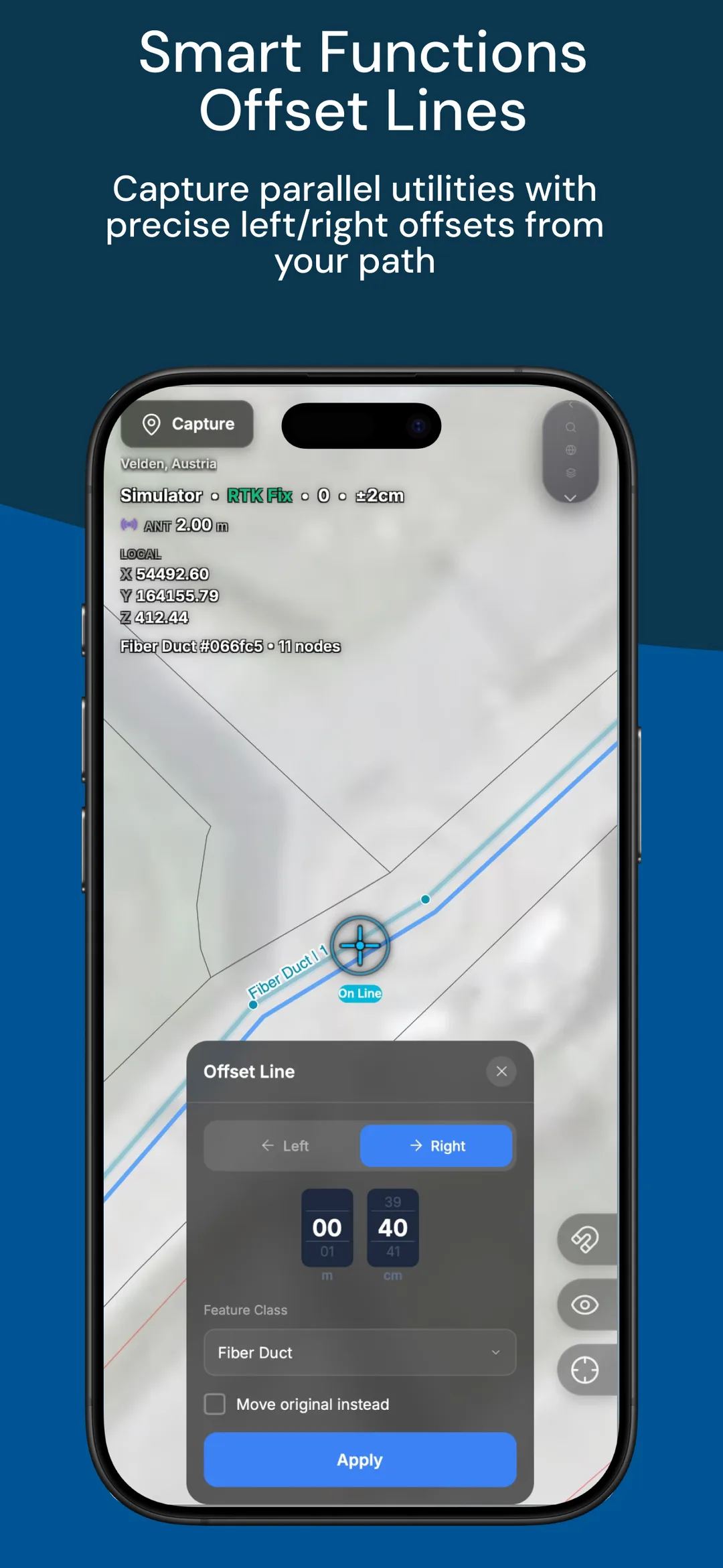
Parallel lines in one pass
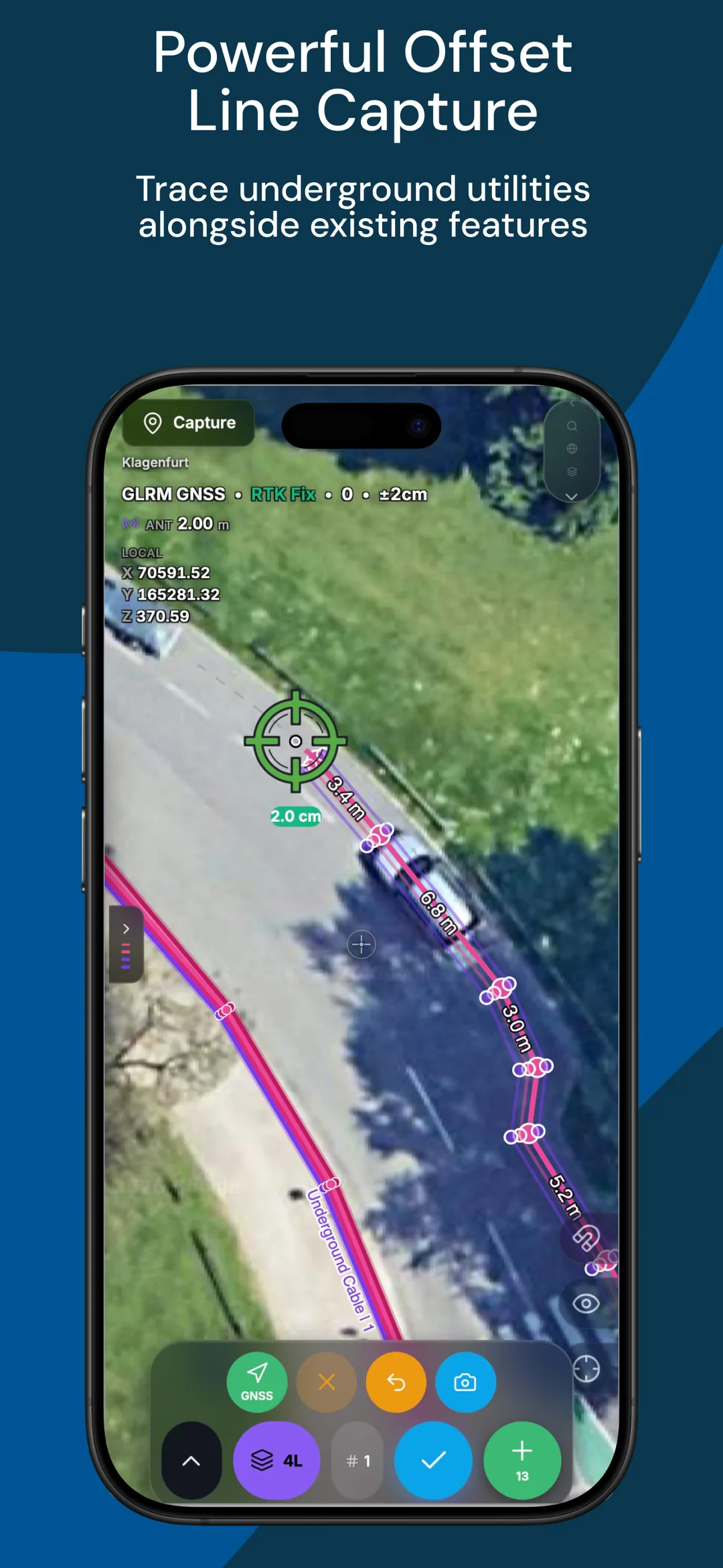
Capture LV/MV cable runs together at a set offset — all lines at once.
Station offset (“Flucht”)
Set out along an offset line — hold a fixed distance off a boundary.
One pass records every parallel run at its true offset — utility line, cable, conduit and fibre, all at the same time.
Set each offset once — give every line its spacing (e.g. 30 cm), reorder & restyle
All lines captured together — as you walk, at RTK centimetre accuracy
Built for multi-service trenches — LV/MV cable, conduit, fibre duct
One correctly-spaced network — no re-walking, no office rebuild
Intuitive, easy, powerful. Less field time — and no office post-processing.
Offsets to the curb, reference line or existing utilities appear as you draw — clean, review-ready dimensions with no desk work.
Auto-Dimensioning
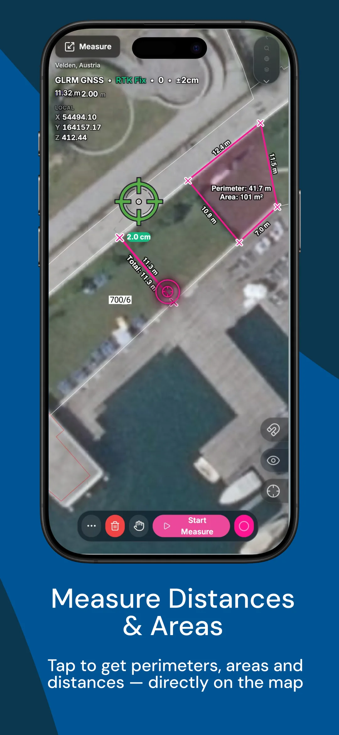
One tap dimensions every offset from the reference line — no manual measuring.
Clean, readable dimensions
Consistent annotations on every line — ready for the locate report.
Snap to features & CAD
Dimensions lock to captured features and imported DXF/DWG geometry.
Built for the pole, not the desk
Big touch targets, one-handed — fast and easy in the field.
Walk the trench once. NEO lays a fixed-width cross-section at every station and totals the area live — and the finished run flows straight into a ready-to-bill report.
One pass, station by station · live area total in m² · auto Aufmaßbericht — no office re-measure
Build on the right side of the line
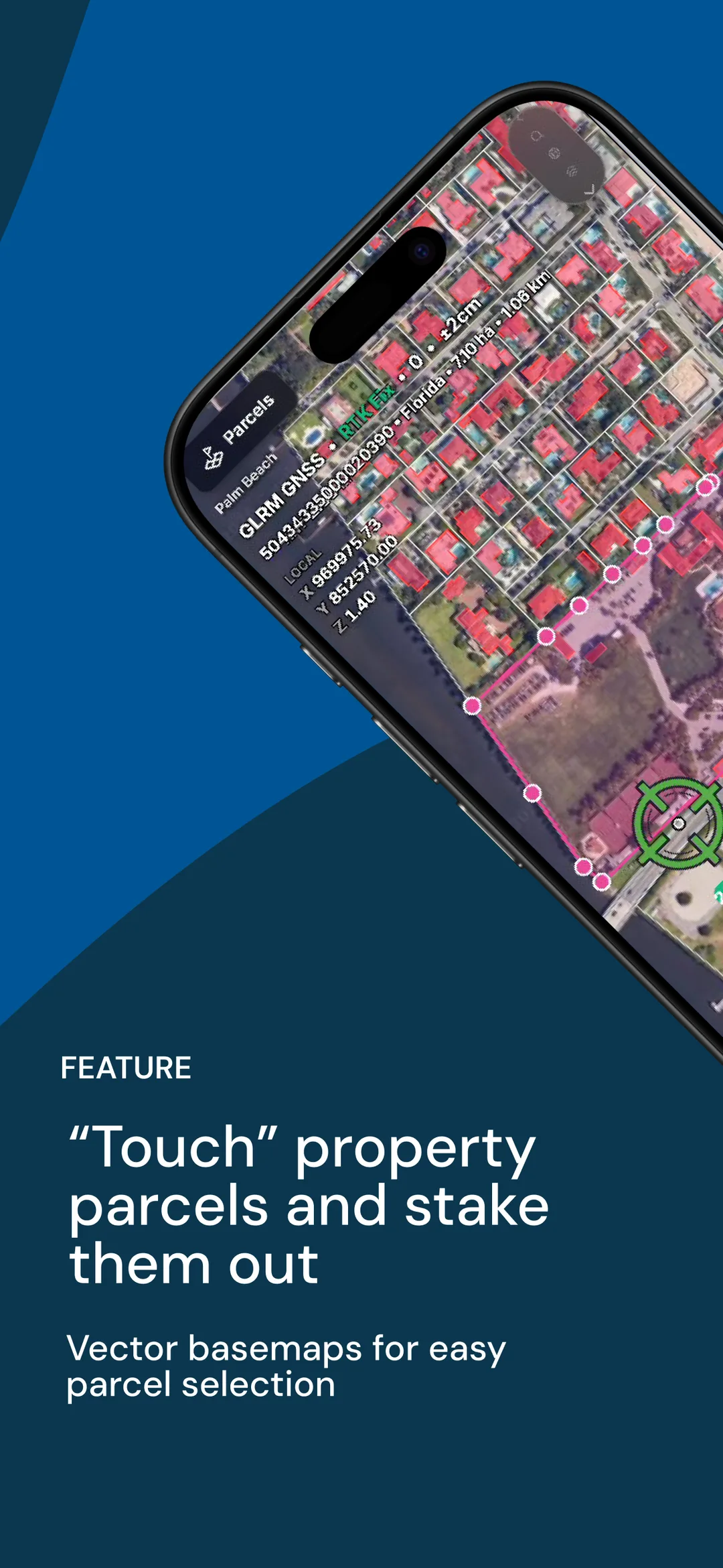
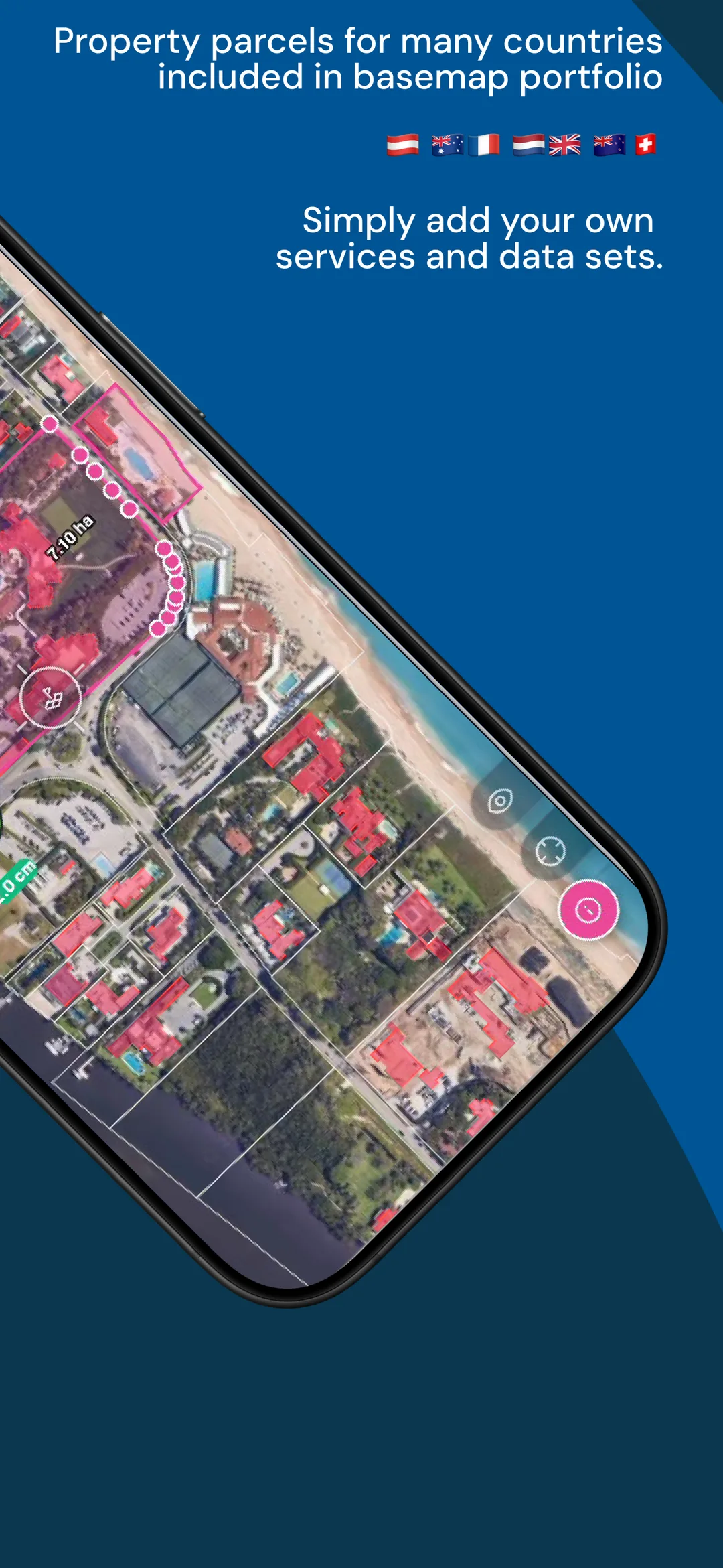
See public vs. private instantly — build on public land, never on a neighbour’s parcel.
Keep the legal setback
Stake a parallel offset — a fixed 1 m “Flucht” off the public boundary. The offset line does the geometry.
Zero preparation
No downloading, importing or transformation juggling. Official boundaries are just there, in your project CRS.
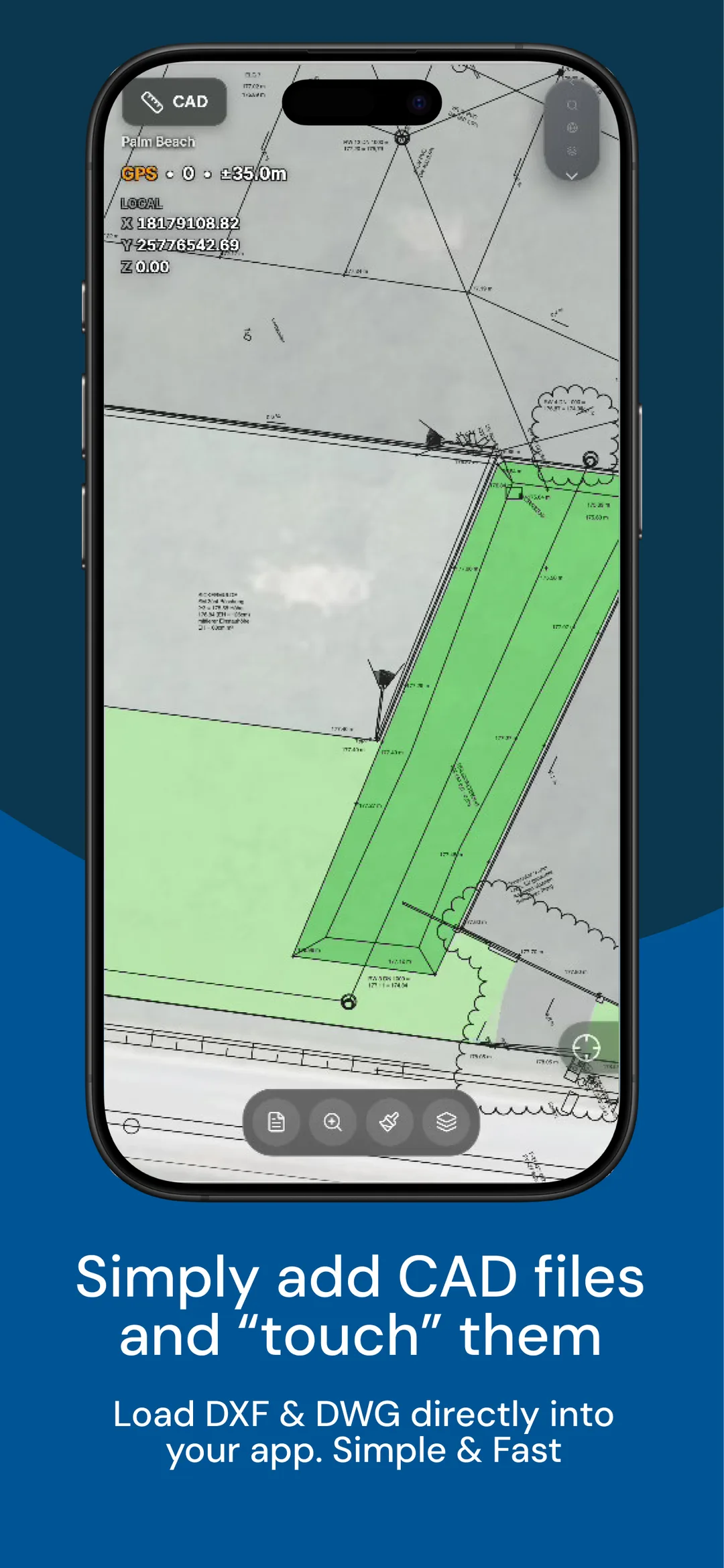
Upload your design and use it as a live reference or a stake-out target — no desktop round-trip. No CAD? Drop a PDF overlay (utility info) or a drone-georeferenced image instead.
Fast DXF / DWG upload — straight from the device
Handles large drawings — no choking on heavy files
Snap to objects — blocks & insertions
Snap to line — endpoints & along edges
Layer switching — show only what you need
Pin a layer to make it stakeable
Pick a target and walk to it. A live arrow, distance and cut/fill guide you straight in — no manual, no setup. Points, lines, offsets: the same simple flow every time.
Stake points — live direction, distance and height to the target
Stake lines — follow the alignment, stay on-line
Stake offsets — hold a fixed parallel distance off any line or boundary
Any target — design points, CAD layers, cadastral lines, captured features
Cut & fill — know exactly how far, and which way
No preparation — pick it, stake it. That simple.
“With GeolantisNEO we reduced documentation time by 75% while increasing data quality. Geolantis is now indispensable.” — Manuel Leitgeb · Planning & Surveying · DPB

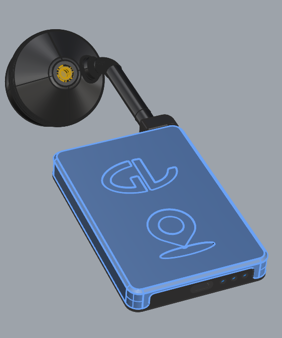
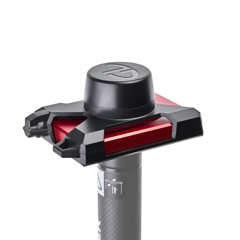
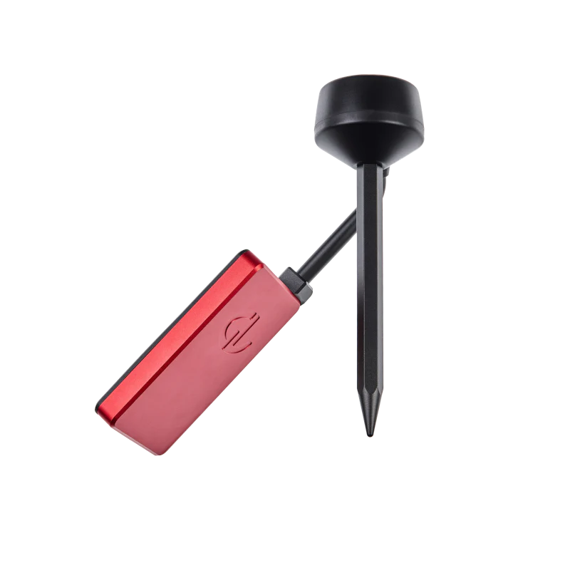
GLRM turns GeolantisNEO into a real RTK workflow — centimetre-capable positioning your crews control from the same app. Two form factors for how they work: a professional pole antenna and an ultra-compact phone antenna.
5/8″ pole-mount surveying antenna.

Ultra-portable, with detachable minipole.

One standard, every crew. GeolantisNEO turns hundreds of field users into a single, governed data pipeline — from the point captured on site to the systems your office runs on.
Simple field capture. Fast creation of deliverables.
Simple field capture — crews capture, visualize & document buried cables straight from the field, with Vivax-Metrotech & Radiodetection locators
Offline-first — uninterrupted data collection, even in remote locations with no signal
Real-time cloud sync — records update automatically; every stakeholder gets reliable info instantly
CAD & GIS-ready on the spot — built-in validation cuts errors and delivers outputs immediately, less office rework


Locate the buried network, capture depth & attributes, hand over the as-built — straight to GIS.
Every parallel run captured in one pass at its true offset — LV/MV, conduit and fibre together.
Set-out, measured booking and CAD on site — measured once, from plan to invoice.
Everything IT and operations ask before a fleet rollout — answered.
Swipe through the field app — capture, stake-out, offset lines, live parcels, measuring and CAD.
GeolantisNEO
Capture, stake out, dimension and document — straight from the plan on the phone your crew already carries, synced to the office to the centimetre.
Field reality
The office thinks it knows what is underground. The field finds out. That gap is where strikes, redesigns and disputed as-builts come from — GeolantisNEO closes it.
No more paper
Rolled-up drawings tear, blow away and never show where you are standing. Put your plans on a live map and keep every measurement and photo in one place.
One app
Capture, stake out, GIS, photos and reports — GeolantisNEO brings every field workflow into a single, multi-user app on shared live data.
Stake out
Your trained crew stakes out points with live GNSS guidance to the centimetre. Import your coordinate list and start on site immediately.
Capture
Eleven field modes, one app. Capture geometry, measure distance and area on the spot, and add offsets for every parallel run.
Measured booking
Lay a fixed-width cross-section at every station, total the area live, and flow the finished run straight into a ready-to-bill report.
Cadastre
Work with cadastral parcels for many countries — tap a boundary, read its dimensions, and stake the corners without any preparation.
Damage prevention
Capture, evidence and report locate outcomes with professional spatial accuracy in the field — standardised and defensible, not sketched and re-keyed at night.
Field to office
What your crew captures on site lands on the office screen in real time. Same data, one truth, no re-keying. Works offline and catches up the moment you reconnect.
Hardware agnostic
Connect the GNSS receiver you already own, or clip on the pocket-sized GLRM for ±1 cm RTK. Bring your own hardware, keep your workflow.
Interoperable
Capture once in the field, then export in one tap. Coordinate-aware, ready for the office, no re-typing.
Proof
Join hundreds of construction and survey teams already turning field work into trusted spatial intelligence with GeolantisNEO.
Get started
Start free on iPhone, iPad or Android — no credit card. Scale to cloud collaboration and enterprise rollout when you’re ready.